The collaborators in this project have been working very hard. The planning for the exhibition layout has been discussed and walked through. We will start setting it up on 4th September ready for an opening night on 6th September.
An exhibition zine has been created, with contributions from all 17 participants who were able to complete the year-long project. This has been put together by the talented Andy Johnson to whom we are all very grateful. Additionally Anna Bergqvist at the Postgraduate Arts and Humanities Centre (PAHC) at Manchester Metropolitan University (MMU) kindly awarded me the funds to pay for its printing costs. It is back from the printers and we will see it ourselves for the first time on Wednesday.
This is a recording of the Inclosure Award for Volca Common Meadow as read out on the enclosed Common on 31st August 2024. It is in the parish of Stoke Prior near Leominster.
The Award itself runs to 15 parchment sheets of sheepskin, plus a map.
I have attempted to read and write out the text, some words are unclear or damaged.
This reading is an abridged version, missing out the lengthy details of allotments made, but the Award can be viewed at Herefordshire Archive and Records Centre (HARC).
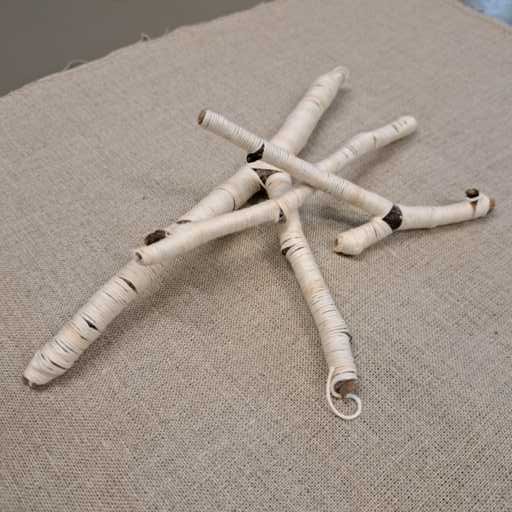
This performance piece is a part of my response for our exhibition Walking the Commons, presented at HARC from 10th September to 31st December 2024 alongside the contributions of all the other participants. I have written a piece about the inclosure of Volca Common Meadow in our Exhibition zine.
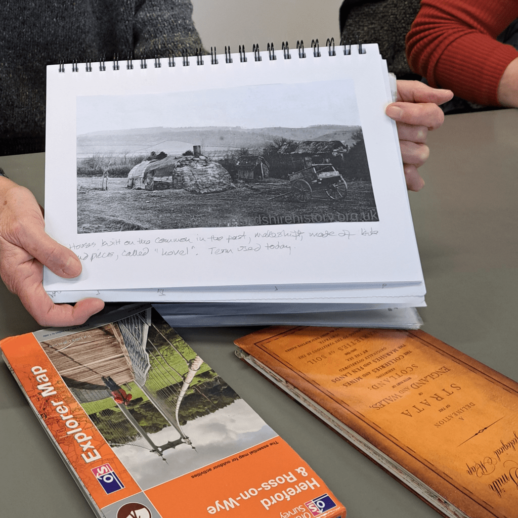
Caroline’s research into houses built on the commons. If a squatter could building ‘a house in one night’ and have smoke coming out its chimney by dusk they could lay claim to the legal freehold of the property
The task A New Year and we’ve moved into the winter season for exploring our commons. I’ve tasked participants with visiting their chosen common at least once for each season, and documenting their thoughts and feelings about walking there, in some way. If participants wish to, in September they can contribute to an exhibition at HARC of their response, in any medium of their choice. Or they may show their journal or extracts from it. In the year long project there are 22 participants in total investigating places that are ‘land shared in common’ between them.
About Herefordshoire land held in commons In Herefordshire alone I calculate there are some 196 commons remaining, 42 village greens, 1 country park (Queenswood Country Park & Arboretum), 1 Doorstep Green Polygon (Hunderton Community Open Space), and 4 Millennium greens (Kingsland, Eadrisley, Rosemary Rigby and Leominster Riverside). From the Council’s original list of 245 commons in Herefordshire of which it says 198 registered commons remain, 32 are now listed as cancelled, 10 void, 6 deleted and 1 removed. A few of these have been incorporated into Village Greens or other existing commons. In total, the registered commons cover 2023 hectares. Of these 198 commons the council website says:
12 are registered to Herefordshire County Council (comprising 301 hectares)
60 registered as Section 45 commons (168 hectares)
13 registered as Part Section 45 / part owned commons( 101 hectares)
31 registered under 1899 Commons Act (332 hectares)
113 privately owned commons
Of the Village Greens , 7 are owned by Herefordshire County Council.
Queenswood ‘Country Park & Aboretum’ at Dinmore and Bodenham Lake “are retained in public ownership through Herefordshire Council and are leased to the partnership via a 99 year leasehold ‘community asset transfer’.”
I’ve asked participants to drop in to discussion meetings held once a month at HARC and from this meeting onwards we are just discussing findings and sharing outcomes, rather than me inviting speakers along. This is to maximise the time that participants have to share their work. It works well this month when the group divides more evenly into morning and afternoon sessions.
The morning meeting at HARC
Eleven project researchers attend. Unfortunately my phone camera (well me) did something random and stretched a lot of my photos, hence I’m not showing all work here as I wasn’t able to ‘repair’ the photos satisfactorily. Apologies for missing a lot of work out, but we will see more in the future!
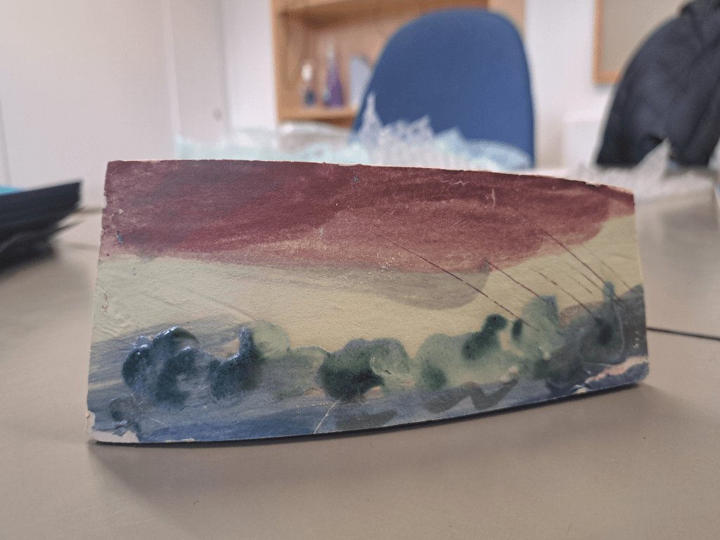
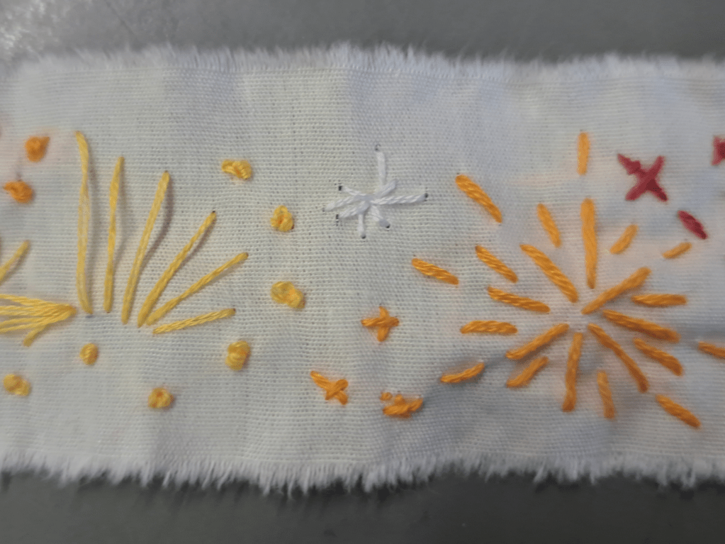
Some of Jane’s initial responses to Bromyard DownsWork finely focussing on the minature in a small heart shaped area of the larger commonOne of Bryony’s responses to the horizon lines of Bradnor HillCommonViv’s depiction of fireworks on Bishops Meadow – reminding her of Hong Kong experiences
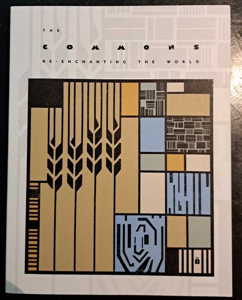
Andy brought in this book to share with the group and kindly lent it out to another participant. He is reading around his chosen common and the commons more generally with a view to crystalise his findings into a painting.
Andy’s recommendation
The afternoon meeting
A smaller group of five plus myself, but thought provoking converstaions abound. The afternoon group also decide to set up a Whats App group for the project to share commons related information and Jo kindly facilitates this. I will email her invite out to all Walking the Commons participants, for those that wish to join it. I will continue posting this project’s research information on this website.
I love Jo’s description of the Whats App group:
A group for us to share Walking the Commons satisfactions and stumbling blocks, discoveries and queries, fascinations and 'fed-up-with's.
I think this perfectly summarises the general thoughts expressed across both meetings today about initially approaching and tackling the task I have set. My reassurance is that there are no rights or wrongs, that you should follow the ideas or leads that excite you (with personal safety in mind though) and to just ‘go for it’ creatively. If anyone fancies writing a blog or a photo blog for this website, please do send it to me.
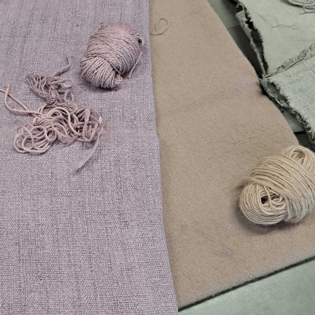
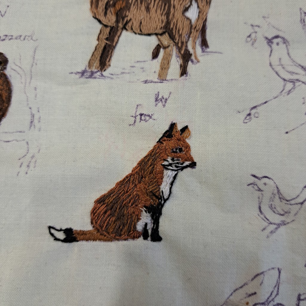
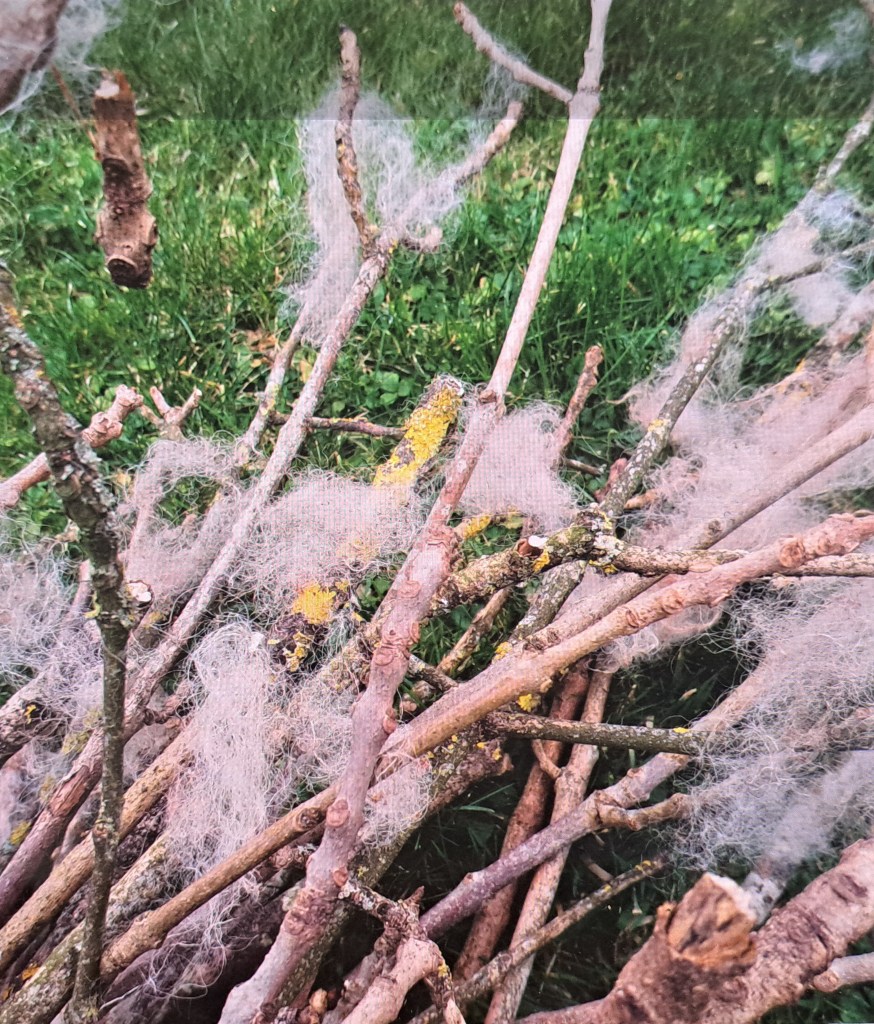
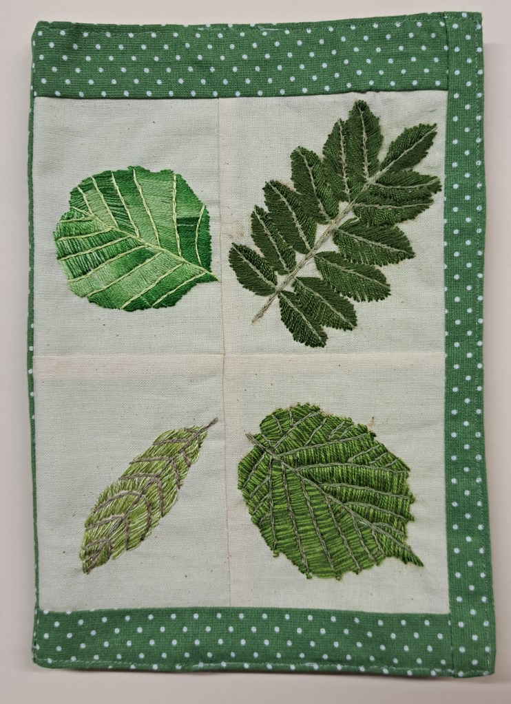
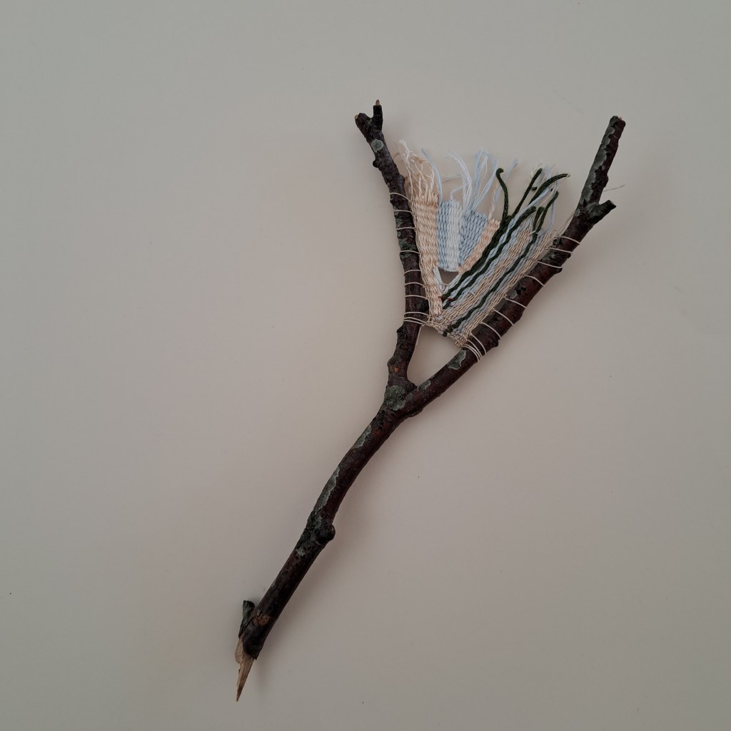
Helen’s fabric and thread dyed with gathered plant materialFabric dyed with gathered plant materialMeg’s expressions in stitch of Climbing Jack fauna.A photograph of a sign found on Tillington CommonWool caught on sticksJo considering shoes
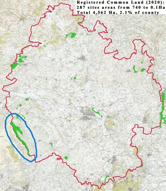
The common I’m walking on is the northern part of the upland commons along the Wales/ Herefordshire border, above the Olchon Valley, encompassing the popular Cats Back ridge walk. It’s part of a series of continuous commons, circled in blue on the left-hand map below, each with its own register of commoners. From the walker’s viewpoint it’s a seamless area and it adjoins commons on the Wales side of the Hatterall ridge so it’s part of the vast Black Mountains commons.
(thanks to David Lovelace for this county base map.)
Lines bisecting open spaces
We now associate commons with openness and unbounded access though of course their history encompasses land enclosures, dispossession and lots of demarcation, definition and line-drawing for the purpose of rules, limitations and specificities of land use that have changed over time. Major social changes have been caused by imposition/introduction of lines onto the landscape.
The uplifting, expansive experience of wandering – above hedges or fences – high up on open-access ground with big views, links to a concept of poetic freedom from boundaries, segmentation, order.
Today I want the sky,

The tops of the high hills,

Above the last man's house,

His hedges, and his cows,

Where, if I will, I look

Down even on sheep and rook……


(Edward Thomas, ‘The Lofty Sky’, 1915)
But actually many linear features I notice, walk along and cross over do draw my attention.
There are the geo-political lines – invisible on the ground (well, sometimes surviving old boundary stones can be spotted) though prominent on maps – such as political/administrative boundaries (nation, county, parish, diocese) or boundaries of ownership and commons rights areas. There’s the watershed line, a drawn line on some geological maps but not that clearcut on the ridge or valley top itself. There’s the sheep-hefting line within which a flock should stay when grazing the commons;.
The sheep don’t read the commons registration documents * which show where their owners’ rights officially start and finish. But sheep do have an innate awareness, learned from the flock’s matriarchs, where their hefted area is. (* Or do they?)
I was a bit surprised how many visible lines I stopped to ponder within the commons landscape. The ridgeline against the sky is a big presence viewed from below. Tracks made by humans, sheep, ponies or a combination, sometimes stand out and sometimes don’t, depending on the lie of the land, the vegetation or the angle of the light.
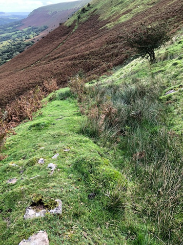
In this border area many landscape features have Welsh names; the term rhiw, which literally means slope in Welsh, also refers to a well-worn track, usually (part-) constructed on a steep hillside by humans centuries ago, always on a diagonal or series of zig-zag diagonals to ease the steepness. If you’re walking on a rhiw you can be sure that many, many generations have used it before you.
4-way track junction in the autumnal bracken
This rhiw (shown below) has a stone bank built on the downslope side; probably it’s as much an old water-management feature (ditch and bank) to persuade the rainwater down towards a dingle stream, discouraging water from washing freely directly down into fields below.
The rushes growing on the rhiw path/drainage ditch mark an area of water saturation coming down the steep slope then caught by the bank and funnelled diagonally downwards.
Along the ridge top, the Offa’s Dyke long-distance trail is a well-worn track (visible on Google Earth) mostly surfaced with imported gravel or large stone slabs (periodically brought in by helicopter); it’s a popular route and the paving equally benefits both walkers (keeps feet out of bog and wet peat and is a clear path in foggy conditions) and plants because it discourages walkers from creating braided paths by trampling extra bare strips either side of the main pathway.
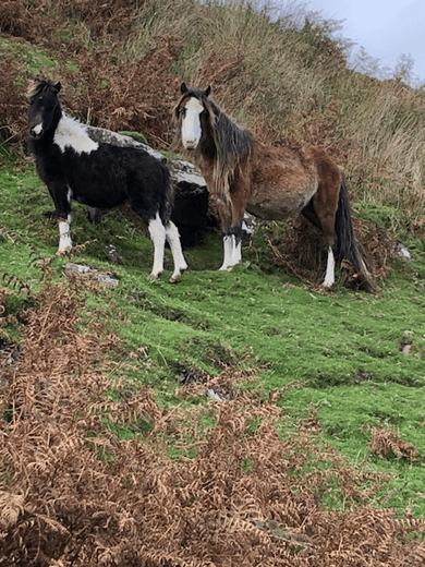
The hill ponies don’t care about the paths, the Wales/England border or any other lines they cross and recross but they do enjoy embellishing the scenery for admiring walkers.
My favourite line high up on the local common is the Fynnon Line (fynnon = well or spring in Welsh). This is a Black Mountains geological feature where bands of limestone and conglomerate outcrops emerge from the red sandstone and contour round the upper slopes of the steep valleys, the source of many of the hill springs.
The boulders of the fynnon line provide crevices and hidey-holes where trees, bushes and plants can get a hold and grow, protected from the lawn-mowing voraciousness of the sheep’s constant nibbling. It’s a diverse habitat, different from the rough grass, boggy sedges, bilberry and heather which carpet most of the common.
Rowan berries at the fynnon line, early autumn.
This 1922 OS map excerpt (shown below) shows the lack of ‘lines’ on the commons (left half of the image) compared with the many lines shaping fields and farms lower down (right half).
The Wales/England border is clear (dot dash, bottom left corner) as are some footpaths. The band of the fynnon line is represented by the curly, roughly parallel lines that contour within the open common. There are many more streams than those actually marked, some only appearing as temporary white ribbons down the hillside at times of very heavy rain.
Maybe some lines and their impacts on history will be in my mind if I create any artwork for this project………
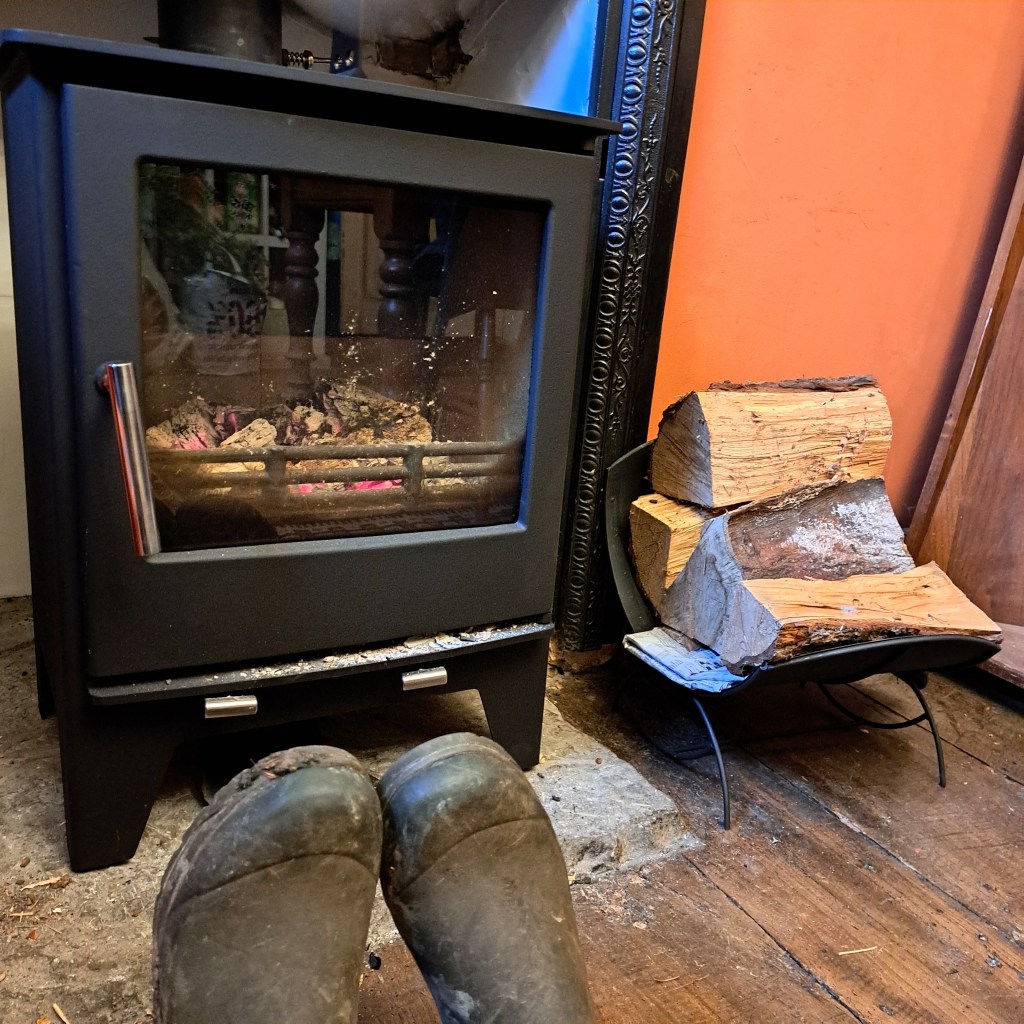
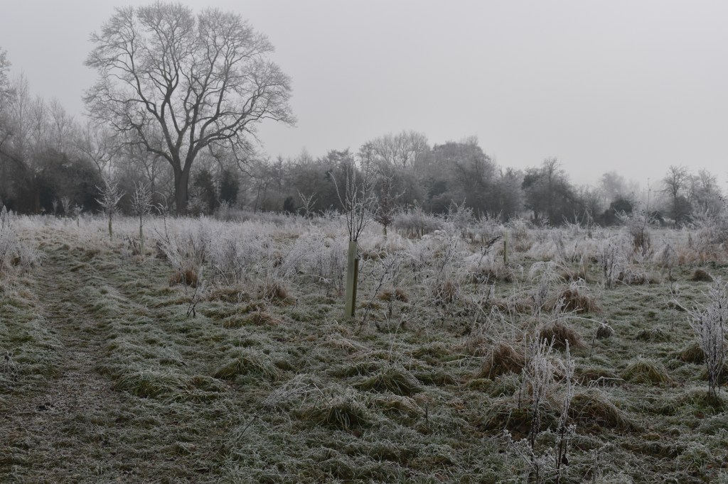
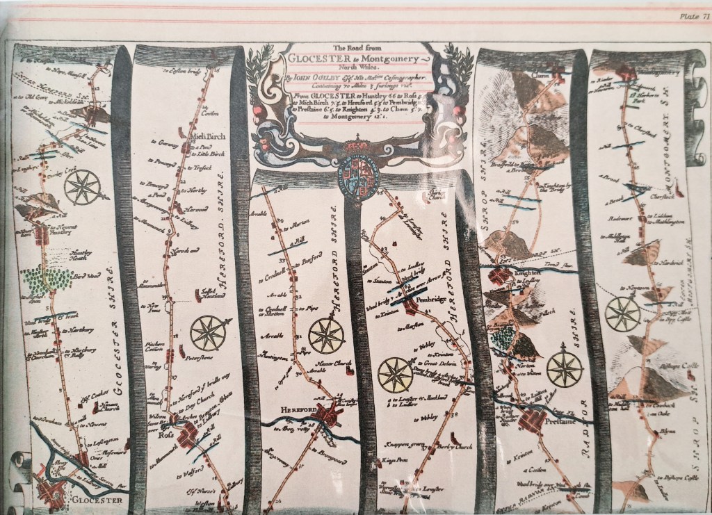
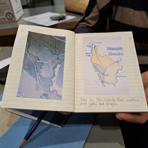
A walk from my house to find Volka Meadow, I have the old map that David Lovelace kindly sent me and have tried to overlay it on a modern map, but I’m not exactly sure how the areas relate. There’s a hoar frost so we wrap up warm; Graham preheats my wellies by the stove!
Along Station Road
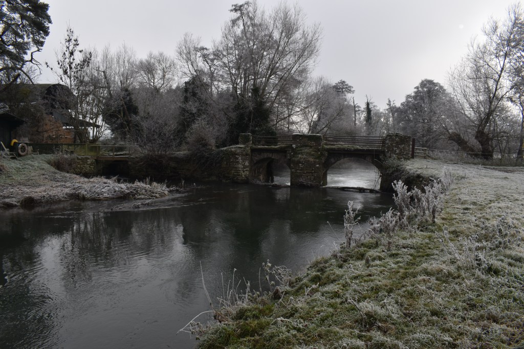
Over the old bridge
Past the horses
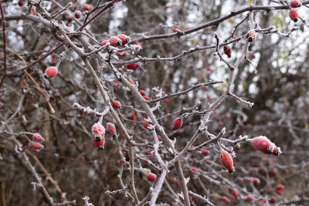
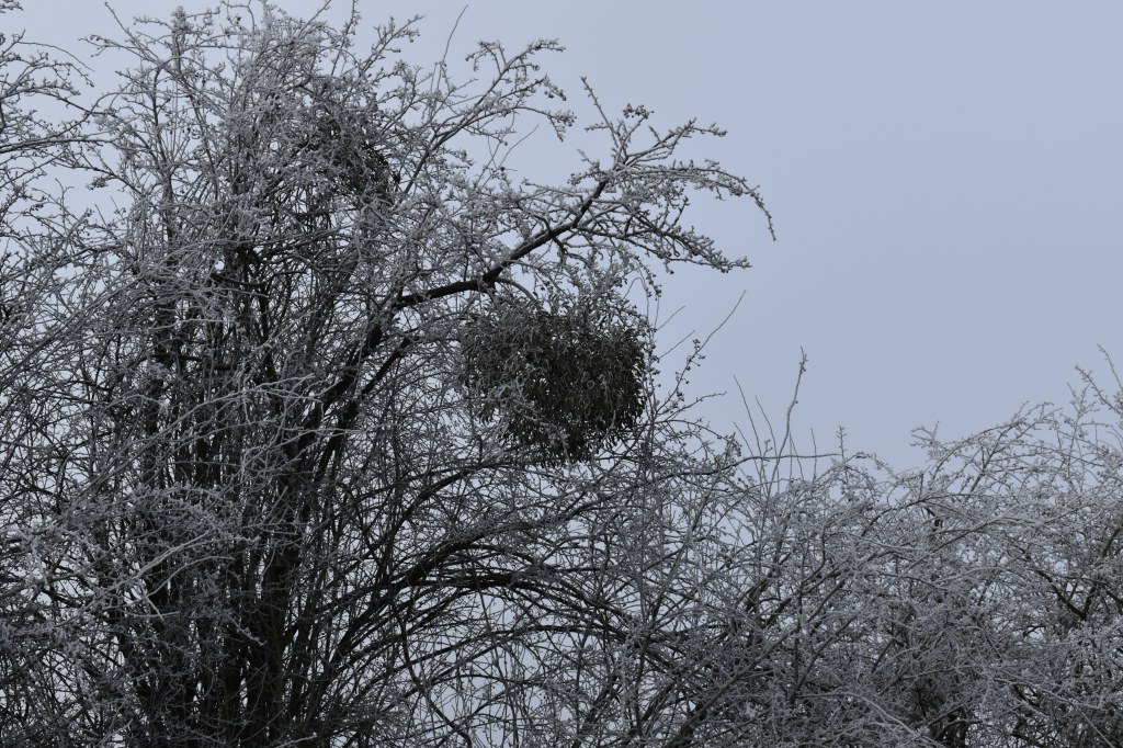
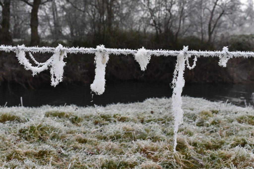
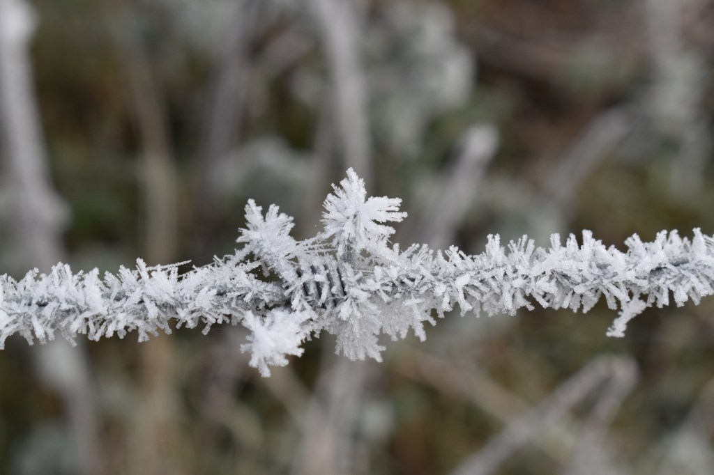
It’s all so beautiful, every line and surface etched in frost. Special conditions of surfaces already being below zero as the water droplets landed, building layer on layer of ice
Here’s where I went wrong. I assumed this was the Old Volka bridge on the map, but in fact I realise after the walk that this was the bridge before Volka Bridge. Hence I incorrectly assumed that the following land we walked across, following the public footpath, was all part of Volka Meadow. As it turns out , only the last part of our walk was on the Meadow. It’s a reason to go back at any rate. We walk on and had hoped to reach the junction of the Lugg with the Arrow but it’s too cold and we turn back.
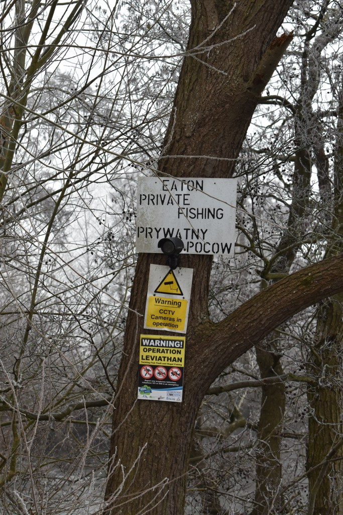
Operation Leviathan, aiming to tackle fish theft? Named after something from the Bible? I later look it up – it’s a sea monster, in biblical use identified with the whale, and the crocodile and the Devil; also: ‘a thing that’s very large or powerful’. Hidden rural crimes. The entire Lugg is legally free naviagation to all. Obviously not free fishing. Or, fishing is a quiet private thing, don’t tell anyone you are doing it!
Graham comments that this fallen willow branch is how trees walk.
The captured plastics suspended over the river remind me of an installation I created at Hereford Art College back in 2016.
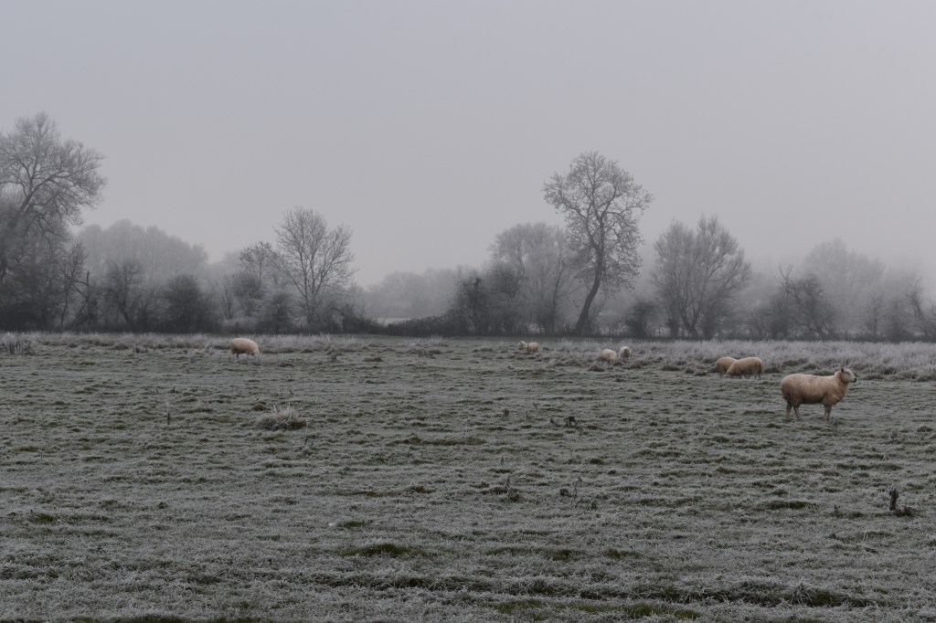
With the benefit of hindsight I can safely say that this image below is of land of Volka Meadow.
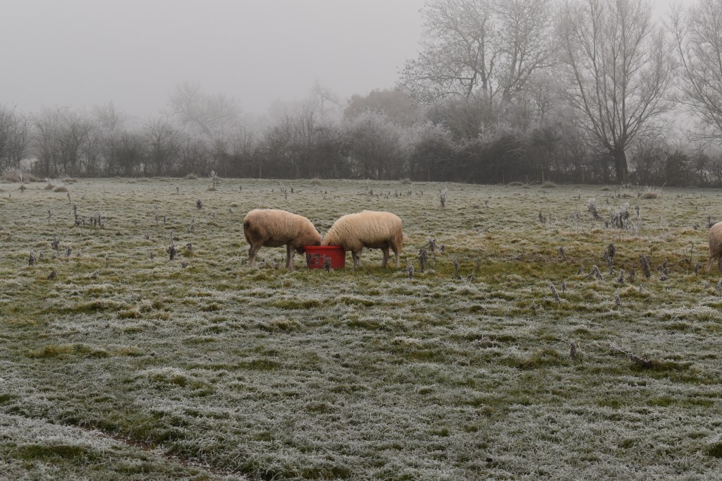
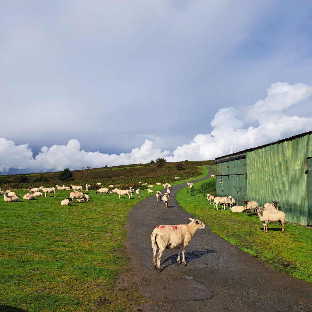
We turn back. Sheep are troughing, a bird sings from the perfect tree.
Back across the railway bridge. This train is heading onto tracks further south that run across part of Volka Meadow. I believe fairs were held on its land too – more research to do.
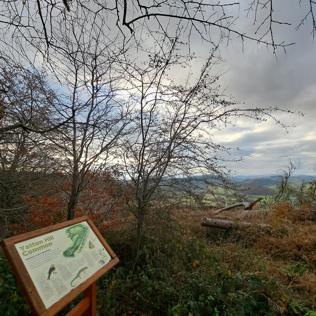
After the worst morning of my life so far, Graham and I set out for Yatton Hill Common. We had stumbled across it before during lockdown but at that time walked up and beyond it to Croft Ambrey Hillfort and climbed the gorgeous ancient oak trees there with our son. Today, we park at Yatton and head up the path shooed along by barking dogs in a house and garden alongside. On the way up a hillside cottage, that we had noticed last time, has been extensively worked on and rubbish piles previously dumped on the track edge have been cleared.
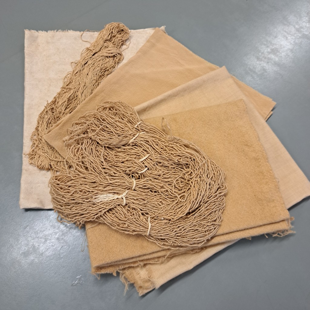
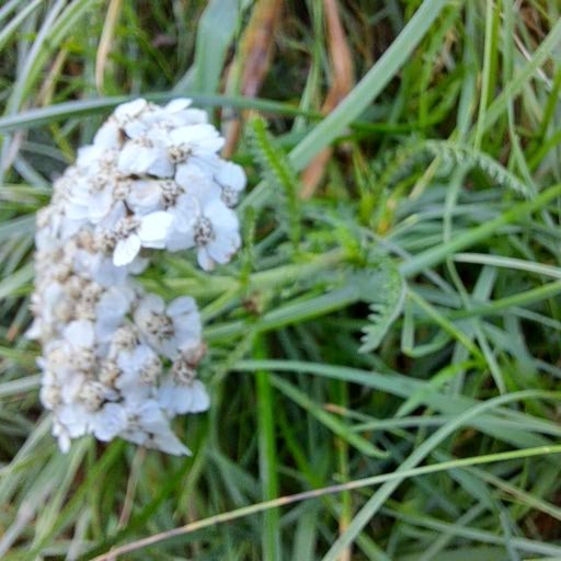
This time we reach the common, sit on the bench by the information board and pick Hawthorn berries from the adjacent bush. I plan to try out making a natural dye for a few threads and fabrics. In my ‘Stitched Atlas’ research group experiencing rural place through its folklore, we had been talking about the Holy thorn which Ella Mary Leather records as flowering in several places in Herefordshire at midnight on old Christmas Day (Twelfth Night). No sign of any flower buds on this bush, and Graham thinks that the Holy thorn would be a different variety to the one in front of us today.
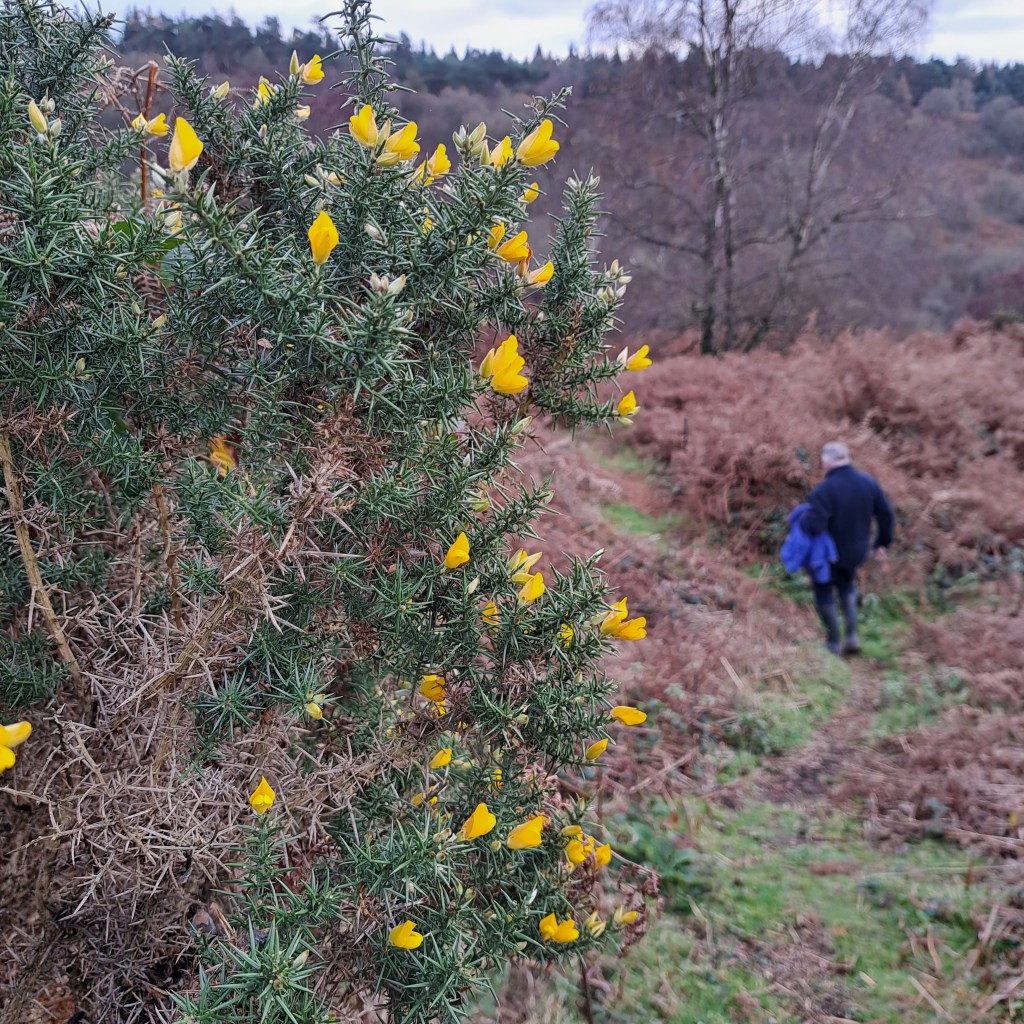
A couple arrive at our bench red cheeked and obviously puffed from a long hill climb from Aymestrey along Mortimers Trail. Their route would take us a long way from our car, with a walk back along the busy road, so instead we take a path heading down and round the side of the common. Graham spies two deer and the ubiquitous robin. We pass a large crop of mushrooms, and step over a stag beetle with staved in armour.
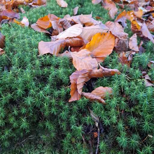
We are astounded by the shots of bright colour amongst the brown autumn mass.
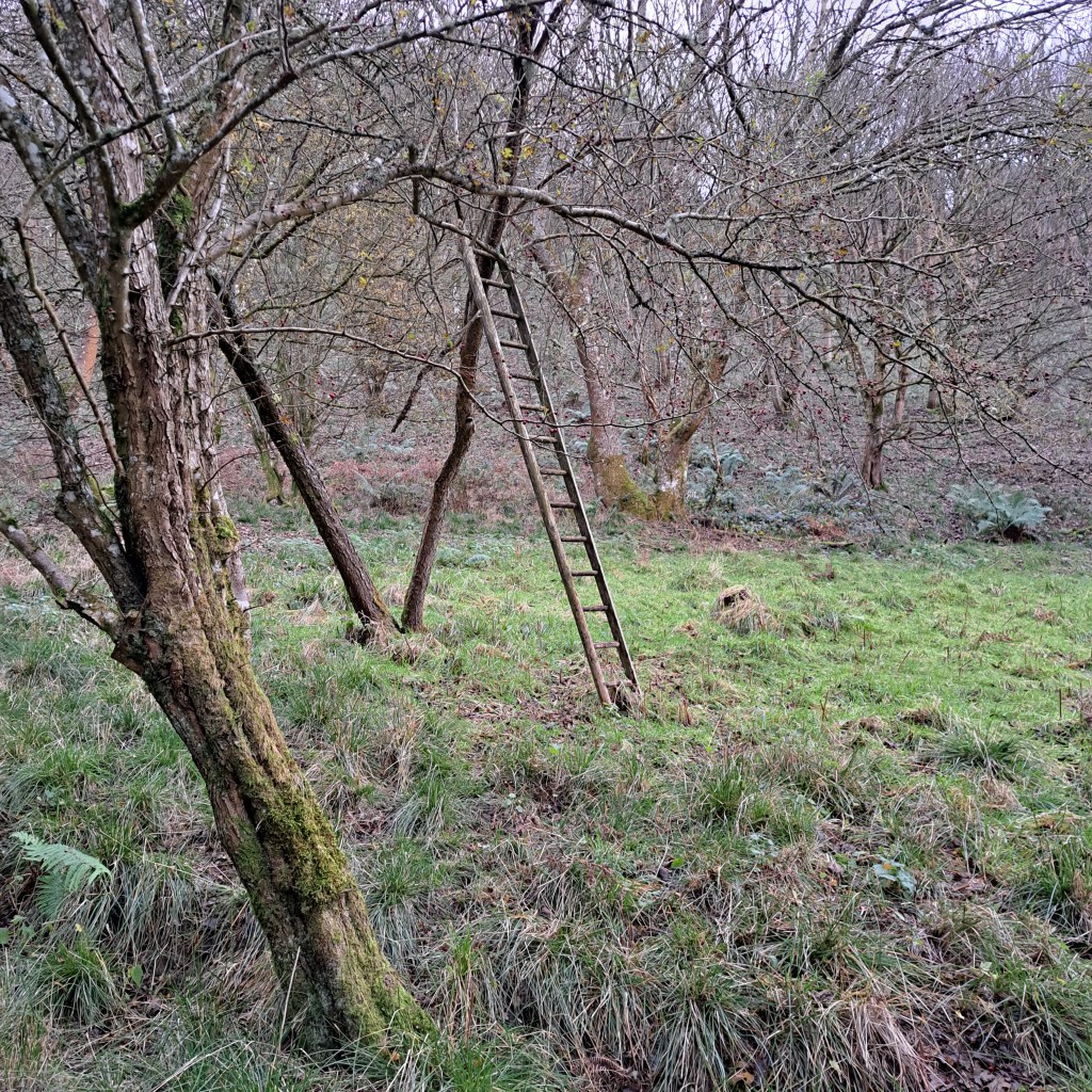
As the hill flattens out, I am strangely delighted to see a wooden ladder leaning up into a tree, and a long length of washing line strung from branch to branch.
A house sits here on the edge of this unkempt common, almost hidden in the late afternoon light. I try to imagine what it would feel like to live there.
We’ve walked just two miles at a slow to steady pace and vow to return to do it again. There’s a magical feel about this common and our spirits are lifted.
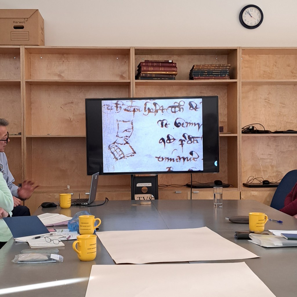
For the November meetings, Rhys Griffiths, Senior Archivist at HARC had
kindly agreed to give the morning group a talk about accessing the Archive and Records and the types of content held therein. I myself felt unconfident in how to go about this and was surprised and encouraged by the breadth of resources available to the public to explore here in rural Herefordshire! Rhys drew us in with wonderful examples from the archive and practical tips to find the material.
We stopped at 11 a.m. to join the Remembrance commemorative service to the women of Rotherwas who had worked during both World Wars in dangerous conditions in the Munitions Factory close by. The memorial stone is outside HARC.
Afterwards group members shared their research so far of their chosen Common. It was a large group so tricky for me to ensure everyone who wanted to, had a chance to speak. A few of the group stayed to share lunch afterwards as they had booked archive research time for the afternoon. One researcher only attended the afternoon session so I shared the mornings tips from Rhys and photos of different approaches people are taking in relation to their common.
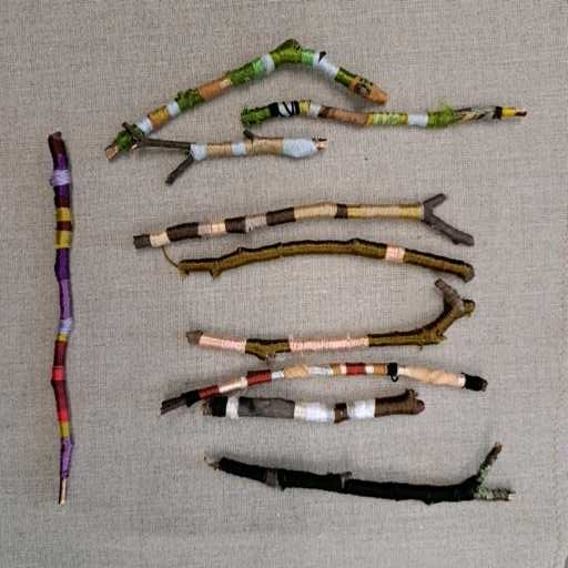
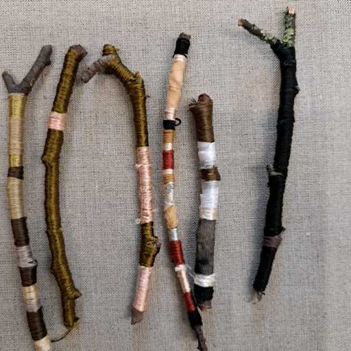
One researcher, Viv,had brought along examples of images of old British Ribbon maps which seem a great way to capture a particular route. She had experimented with capturing her walk in a similar way on cotton spools.
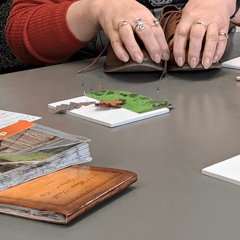
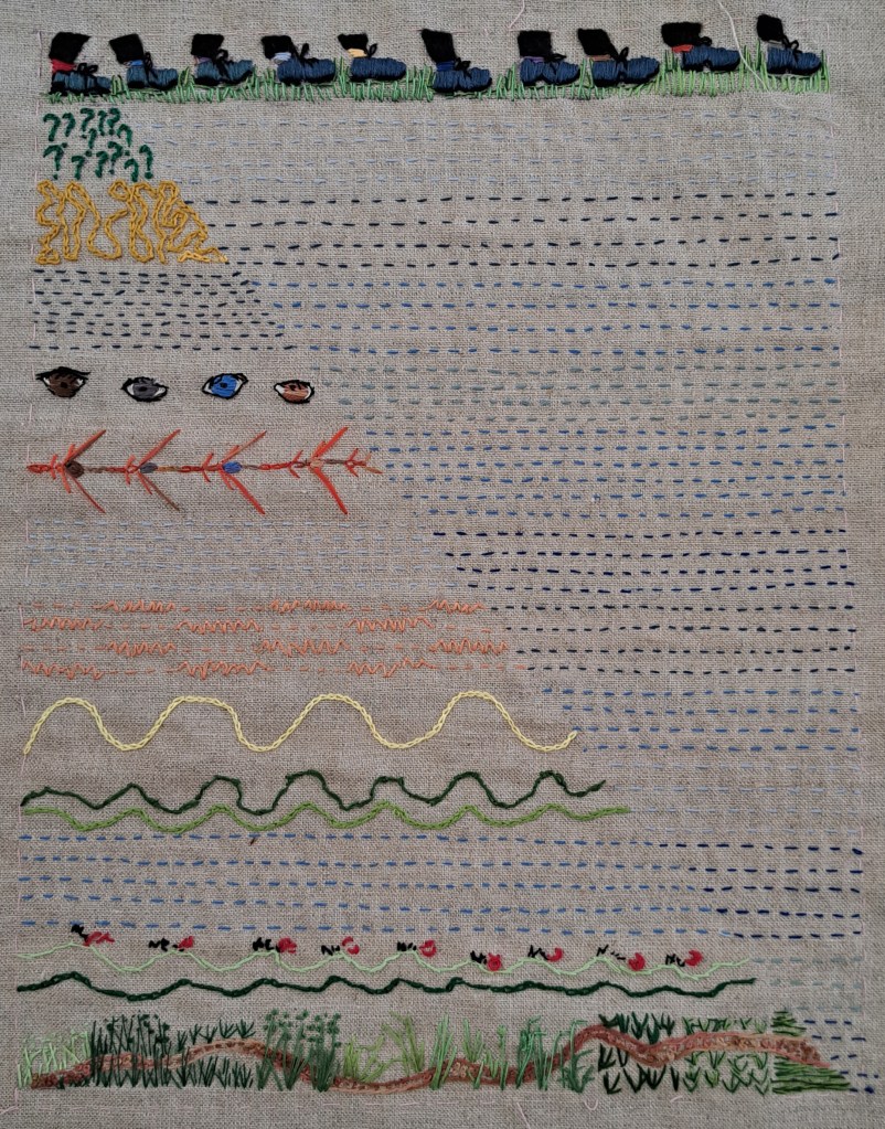
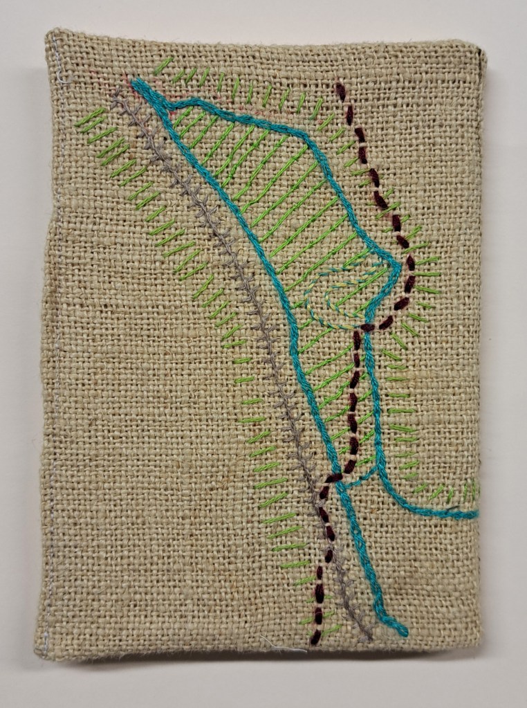
Meg had walked many times on her common and represented each of these on the piece of linen which I had previously given out to those interested in possibly contributing to a shared artwork for next year’s Walking the Commons exhibition here at HARC.
Below are a range of other repsonses shared by the researchers so far to walking on their specific Herefordshire Common this Autumn. We discussed different approaches. One theme emerging today was place and memory, another was ritual and place with the researcher trying out artist/researcher Lucy Wright‘s newly invented Dusking tradition for the start of Winter, see https://tradfolk.co/art/writing/what-is-dusking/ for more details of the new tradition.
At the end of the two feedback and discussion sessions, I came across Viv and Tracy engrossed in the archive!
I look forward to hearing more about other’s research progress on their common as we move from Autumn to Winter. (I had to cancel the December meeting due to a family crisis, but we will meet again in January.)
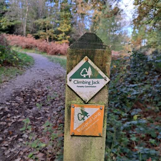
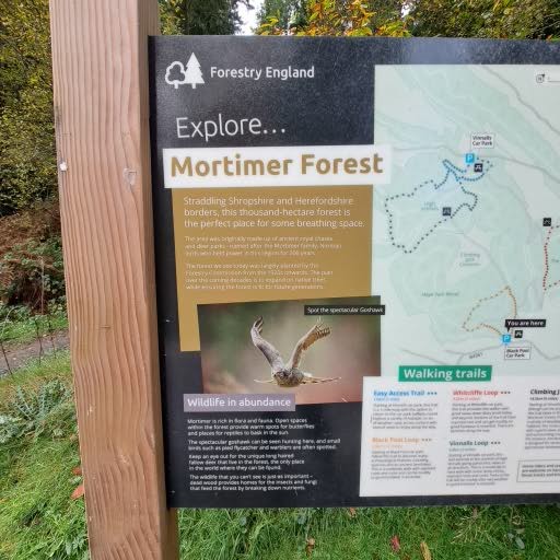
We parked in Blackpool Car Park in Mortimer Forest, just south of Ludlow. The Common lies on the highest point between this car park and Vinnalls car park, and right across the border between Herefordshire and Shropshire, so immediately appealed as I love a bit of borderscaping.
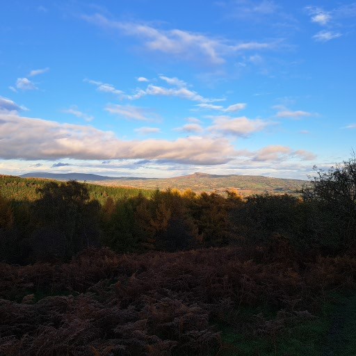
A steady but gentle climb up not realising that towards the top we were on a path edging the common, hidden by bracken and suddenly we were upon this marvellous open space with spectacular views all round and grid like markings in the grass were the land has been cultivated.
So much to see and colours to pick out, trees bowed over like handwriting, one trunk crying like a baby in the wind, stag beetles scurrying, a robin in the bracken and the sun descending.
In the morning meeting we were treated to a wonderful presentation by David Lovelace of his ongoing passion and research into the commons. He has kindly allowed me to share the PowerPoint here for those that missed it and those (all of us!) that would like to revisit it. He had asked for the names of the commons that participants are interested in and had geared his presentation around these too. I feel so lucky to have his expertise and sense he is pleased that the material is being explored. David has also shared his files on the shapes of the commons so a soon as I have downloaded the appropriate software, I should be able to print these out if required by researchers in the group. I feel that I need a timeline of the different historical maps that followed each other, so will endeavour to make a timeline.
I went for an exploratory walk on Bradnor Hill Common with a friend who is also one of the participants, and this is her chosen common. Coffee and biscuits on the highest golf course in the UK with extrordinary views all around. The groundsman and a golfer were very helpful with our questions about the common.